


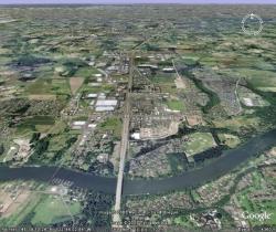
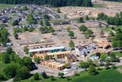
Creating Community

A community must develop a vision. The Planning Division works alongside citizens and businesses to create long range goals and plans to help achieve that vision.
To help guide the community and realize the vision the Planning Division reviews development in accordance with the Planning and Land Development Ordinance (also known as Wilsonville’s Development Code, Chapter 4 of the City Code and as the Zoning Code). Nearly all development in Wilsonville requires a development permit, except those excluded in Section 4.005 of the Planning and Land Development Ordinance, and almost all development proposals must be presented to the Wilsonville Development Review Board for approval.
The development process is designed to encourage citizen involvement. Public Hearing Notices are mailed to properties surrounding the site of the proposed development, soliciting input from those property owners. The public hearing for the proposal is advertised in the local newspaper and notices are posted in at least three locations in the city, on the city’s website, and at the project’s site. The city welcomes citizen testimony. In fact, citizen involvement is the first of the Statewide Planning Goals and the Wilsonville Comprehensive Plan devotes a full chapter to citizen involvement.
The Development Process
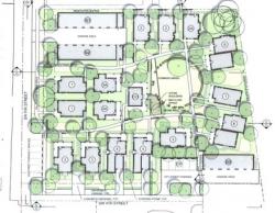
The development process includes looking at both how land is used and how buildings are built. To begin the development process, a development proposal is submitted to the Wilsonville Planning Division where it is evaluated to verify that it complies with City, County, Metro, State and Federal standards. A requirement of the development application is to work with the City’s traffic consultant to produce a traffic study. The traffic study will determine the development’s traffic impact.

After a complete application is received, a member of the Planning Division will solicit recommendations from other City departments. After receiving comments a member of the Planning Division writes a staff report listing what the project is, how it meets or does not meet the standards that apply to the proposal, lists conditions of approval for those deficiencies in the proposal to ensure that it meets all development standards, and gives a recommendations as to whether the proposal should be approved or not.
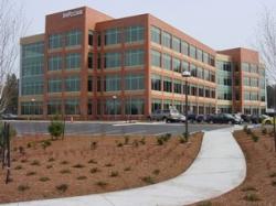
The development proposal is then presented to the Development Review Board (DRB) in a public hearing where the proposal is described and citizen input is solicited. The DRB, after consideration of all the issues, approves or denies the development permit. There is an appeal process for those applicants or citizens who do not agree with the DRB’s decision.
It is important to note that the City cannot deny a land-use application just because “we don’t like it.” The City must, by law, allow development to occur, as long as it takes place in the appropriately zoned areas and conforms to the Comprehensive Plan and City Codes.
State Planning History
In 1973, the state of Oregon enacted a sweeping land-use planning program. This program’s goals and objectives included 19 Statewide Planning Goals that generally aim to:
- Conserve farm land, forest land, and other important natural resources
- Encourage efficient development
- Enhance the State’s economy
- Reduce the public costs that result from poorly planned development.
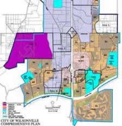
The State also required that all of Oregon’s cities and counties adopt a comprehensive plan which is an official statement about how a city or county is going to develop and how it will manage limited resources. The goals and policies of a comprehensive plan must conform to the Statewide Planning Goals, as well as other State, Federal, County and Metro plans and policies. But a comprehensive plan mostly deals with local concerns about growth. Each comprehensive plan includes a land-use map which shows planned uses for each piece of land in the city. Uses can be residential, commercial, industrial, public facilities or open space. A well-planned city has a good mix of all five uses.
Wilsonville Comprehensive Plan & City Code
Wilsonville’s Comprehensive Plan was the result of five years of intense work involving hundreds of city residents. The Wilsonville City Council adopted the Plan in 1980. It is an official statement of the goals, policies, implementation measures, and physical plan for the development of the city. The Plan documents the city’s approach to the allocation of available resources for meeting current and anticipated future needs. In doing so, it records current thinking regarding economic and social conditions. Because these conditions change over time, the Plan must be directive, but flexible, and must also be periodically reviewed and revised to consider changes in circumstances.
The Comprehensive Plan lists supporting documents that are tools to implement the Comprehensive Plan; they have the force and effect of the Comprehensive Plan. The city uses a two-map system for land use planning, the Comprehensive Plan Map and the Zoning Map. Planners consider both maps when researching potential uses of a parcel of land.
In addition to the Wilsonville’s Comprehensive Plan, specific design and development standards are part of the City Code. All development in the city must conform to both the Plan and the City Code standards. The Wilsonville Development Code which is Chapter 4 of the Wilsonville Code was enacted to ensure procedural due process in the administration and enforcement of the city's Comprehensive Plan, Zoning, Design Review, Land Division, and Development Standards. Proposed development must also coordinate with other city master plans such as the Storm Water Master Plan, Transportation Systems Plan, Public Works Standards, and several other master plans.
The Comprehensive Plan, City Code and master plans are periodically reviewed to make sure that they still comply with Federal, State, Metro, and County standards and policies, and to make sure that they still meet the needs of the community. This legislative review process to amend the city’s governing land use documents or to adopt a new Plan is first undertaken by the Planning Commission who then makes a recommendation to the City Council. The City Council makes the final decision regarding these changes. Citizens are invited to participate throughout this process; many times the documents under review have been forwarded to the Planning Commission by a citizen task force that worked on the document prior to Planning Commission public meetings. As with the DRB hearings, citizens are encouraged to speak to the issues relating to the amendments or new plans.