Basalt Creek
Employment Development Feasibility Study
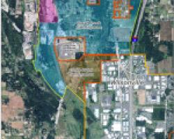
The Basalt Creek Concept Plan Existing Conditions report was prepared in 2014 to look at future development of the 847 acres between the City of Wilsonville and City of Tualatin as part of the Urban Growth Boundary (UGB) inclusion process. In that report, potential land uses were identified for the region based on economic factors, land use compatibility, and projected growth. The intent of this feasibility study is to take a further look at approximately 60 acres within the Basalt Creek Concept area
to evaluate the potential to develop these properties to support increased employment opportunities in the region. This subarea’s potential development is important because of its central location in the planning area and on the main intersection of the Basalt Creek Parkway in the future business district.
What is a Concept Plan and Why do we need one?
In general, a concept plan identifies a vision for the planning area and guides future land use and transportation. Additionally, it outlines an implementation strategy for future provision of urban services (water, sanitary sewer, and storm sewer systems), other public services, and protection of natural and cultural resources.
Although the Basalt Creek Planning Area is part of the UGB, property owners are unable to pursue urban development until a concept plan is completed. Prior to incorporating this land into either City, both Cities wish to address the needs of area residents as well as other community members and set a plan to provide adequate services, coordinate land use and transportation, and preserve natural resources.
How will we get there?
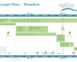
Through your input! This planning effort requires involvement from property owners, community members, elected officials, and other local stakeholders. Interested residents and stakeholders will have the opportunity to voice their input, raise concerns, offer suggestions, and ask questions through a public workshop, open house, community surveys, and public meetings. Based on all of the input gathered, staff from both Cities will devise a plan that seeks to implement the community’s vision as well as regional goals outlined by Metro.
Transportation Refinement Plan
In August 2013, the Cities of Tualatin and Wilsonville, Washington County, and Metro all adopted an Intergovernmental Agreement (IGA) that endorsed the recommendations in the Transportation Refinement Plan. The recommendations in that Plan will form the transportation assumptions for the Basalt Creek Concept Plan.
A combination of new and improved roadways through the Basalt Creek area are envisioned:
- A new five-lane east-west roadway. The new roadway would be an extension of SW 124th Avenue, aligned south of Tonquin Road and extending to Boones Ferry Road. This has been called the “East-West Concept.”
- Improvements to existing roadways in the area, such as Tonquin Road, Grahams Ferry Road, Boones Ferry Road, and Day Road.
- Preserving the ability to construct two new I-5 overcrossings. These overcrossings are recommended as long-term improvements and likely not needed until 2035 or later, depending on growth.
Active transportation improvements include bike lanes and sidewalks consistent with Washington County urban standards, as well as integration of the regional Ice Age Tonquin Trail into the transportation network and consideration of an off-street multi-use path that extends east of I-5. These details will be further refined during concept planning for the area.
Goals and Outcomes
Basalt Creek Concept Plan Guiding Principles
Guiding Principles are intended to represent the collective interests and goals for the Basalt Creek planning area. The guiding principles provide a framework for gathering input and developing transparent and meaningful measures that can help inform the decision making process.
- Maintain and complement the Cities’ unique identities
- Meet regional responsibility for jobs and housing
- Design cohesive and efficient transportation and utility systems
- Maximize assessed property value
- Capitalize on the area’s unique assets and natural location
- Explore creative approaches to integrate jobs and housing
- Create a uniquely attractive business community unmatched in the metropolitan region
- Protect existing neighborhoods and employment areas from negative impacts of new development
- Ensure appropriate transitions between land uses
- Incorporate natural resource areas and provide recreational opportunities as community amenities and assets
For final project documents, select the "Basalt Creek Documents" button below.


